- Home
- Florida Road Map
FLORIDA ROAD MAPS
By Mike Miller Updated August 4, 2023
Florida Road Maps are fun and make travel more enjoyable even in this modern age of GPS and smart phone apps.
You can choose a free Florida state road map from the 9 featured on this web page.
THE 8 GEOGRAPHIC REGIONS OF FLORIDA
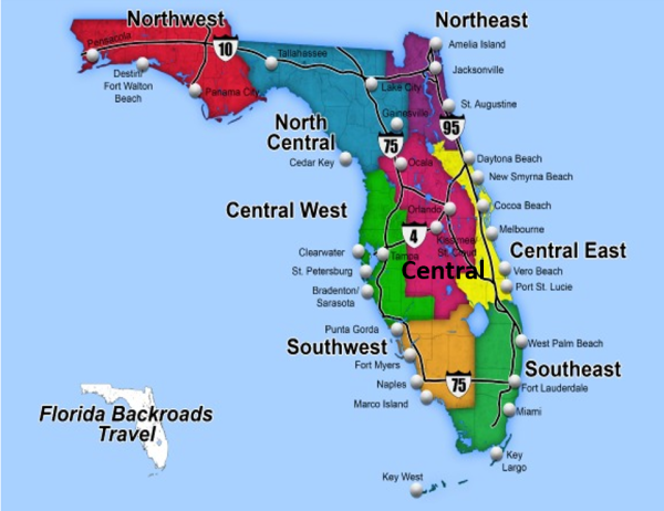 The 8 Geographic Regions of Florida
The first maps are of the 8 individual regions of Florida and can be viewed on your computer or smart phone screen. These maps are actually screen shots from the larger statewide map below.
These regional maps are also printable by clicking on the map and converting the map image to a PDF.
The 9th map, at the bottom of the page, is of the entire state. It is zoomable and can be printed as a PDF. It is probably the most useful Florida road map on our site.
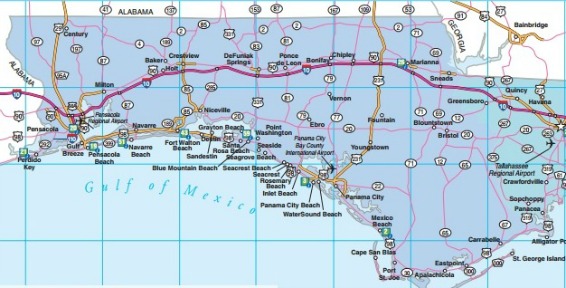
NORTHWEST FLORIDA ROAD MAP
Pensacola, Panama City, Fort Walton Beach, Destin, Seaside, Grayton Beach, DeFuniak Springs, Milton, Carrabelle, Port St. Joe, Apalachicola, Niceville, Crestview, Chipley, Chattachoochee
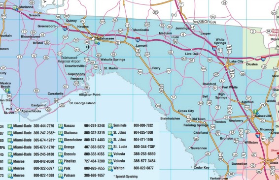
NORTH CENTRAL FLORIDA ROAD MAP
Tallahassee, St. Marks, Sopchoppy, Monticello, Madison, Lake City, Live Oak, Branford, Gainesville, High Springs, Alachua, Newberry, Trenton, Micanopy, Jasper, White Springs
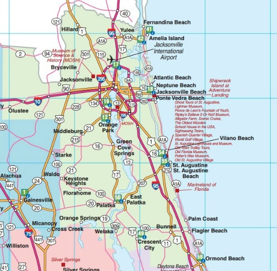
NORTHEAST FLORIDA ROAD MAP
Fernandina Beach, Jacksonville, Glen St. Mary, Macclenny, Marineland, St. Augustine, Ormond Beach, Flagler Beach, Crescent City, Palatka, Green Cove Springs, Penney Farms
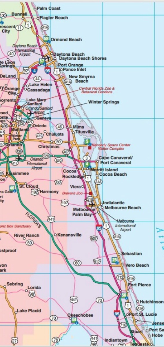
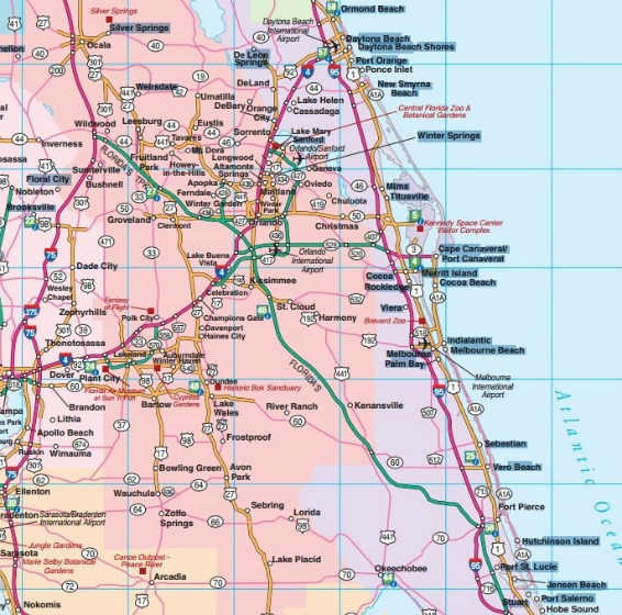
CENTRAL EAST FLORIDA ROAD MAP
Ormond Beach, DeLand, Daytona Beach, New Smyrna Beach, Cocoa Beach, Vero Beach, Satellite Beach, Melbourne, Melbourne Beach, Indialantic, Sebastian, Fort Pierce, Stuart
CENTRAL FLORIDA ROAD MAP
Orlando, Winter Park, Winter Garden, Universal Studios, Wauchula, Walt Disney World, Sea World, Bok Tower Gardens, Altamonte Springs, Lake Mary, Sanford, Winter Haven, Ocala
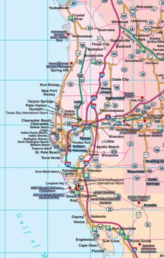
CENTRAL WEST FLORIDA ROAD MAP
Tampa, Tarpon Springs, Sarasota, Bradenton, Cortez, Safety Harbor, Anna Maria, Brooksville, Dunnellon, Homosassa, Crystal River, Englewood, Punta Gorda, Venice, Siesta Key, Gulport, St. Petersburg, Dunedin, Arcadia, Clearwater, Pass-a-Grille Beach
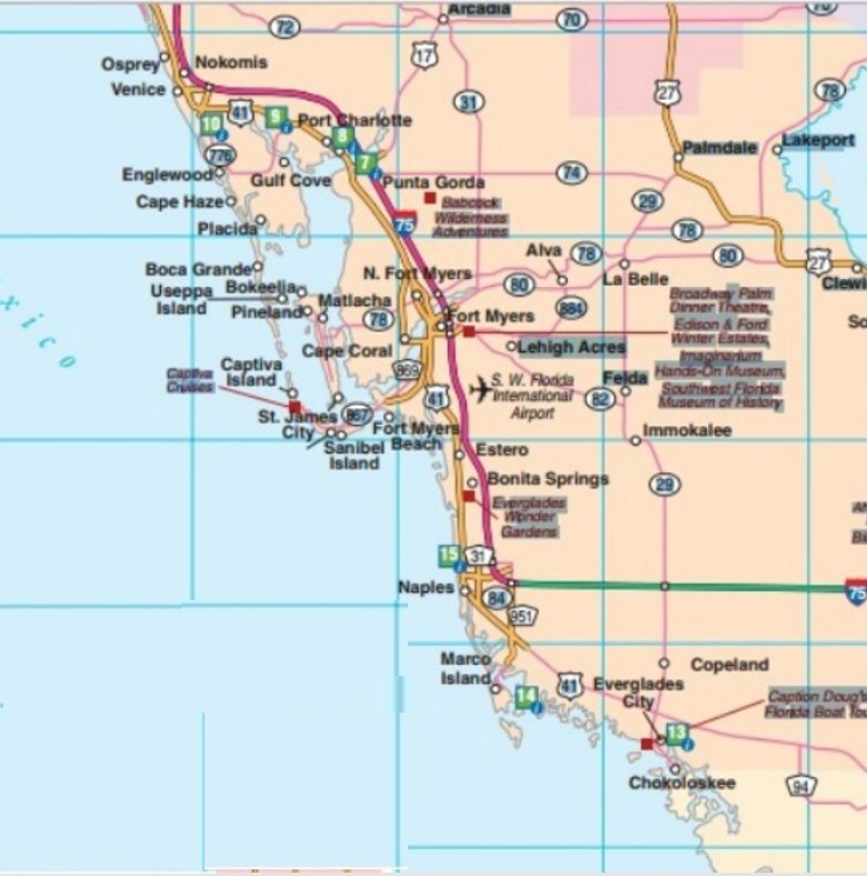
SOUTHWEST FLORIDA ROAD MAP
Fort Myers, Naples, Bonita Springs, Everglades City, Everglades National Park, Chokoloskee, LaBelle, Alva, Marco Island, Captiva, Sanibel, Cape Coral
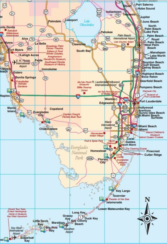
SOUTHEAST FLORIDA ROAD MAP
Fort Lauderdale, Miami, North Miami, Hialeah, Miami Beach, Florida Keys, Key West, Boca Raton, Boynton Beach, Delray Beach, West Palm Beach, Palm Beach, Deerfield Beach, Coral Gables, Pompano Beach, Jupiter, Juno Beach, Jupiter Island, Pembroke Pines, Key Largo, Homestead, Hollywood, Briny Breezes, Surfside, Redland, Coral Castle, Key Biscayne
The State of Florida map below is from VisitFlorida.com, an official State of Florida website. It is a map that you can print out at home or use on this website with its zoom buttons.
Just click on the map image below for all PDF features, including zoom buttons in the lower right hand corner.
FLORIDA STATEWIDE INTERACTIVE PDF ROAD MAP
This map is courtesy of VisitFlorida.com, the state's official tourism marketing corporation. It is a public/private partnership created by the Florida Legislature in 1996.
We also have a Florida County Map Web Page that shows all 67 of our counties with links to highly detailed Florida Department of Transportation maps.
You will enjoy playing with our collection of Vintage Florida Road Maps. The maps are arranged by year. Some of them are interactive.
We also have an official Florida Department of Transportation road map current as of 2023.

Florida is the fastest-growing state in the United States and also the fastest-changing. If you see anything in this article that has changed or is in error, please let me know.
Our free daily Ezine, Florida Heritage Travel, has 18,000 subscribers. We also have 130,000 followers on Facebook who love off the beaten path Florida.
By Mike Miller, Copyright 2009-2025
Florida-Back-Roads-Travel.com
Florida Back Roads Travel is not affiliated with or endorsed by Backroads, a California-based tour operator which arranges and conducts travel programs throughout the world.
