- Home
- Florida Road Trips
- Florida Rivers
FLORIDA RIVERS
By Mike Miller Updated September 13, 2023
Florida rivers were the main routes of transportation in the early history of Florida.
Even before the first European settlers arrived, the Native Americans used the rivers and streams to transport people and goods in dugout canoes made of cypress.
The early Native American footpaths along the rivers connected their villages and formed the eventual routes of many of our modern roads.
As Florida and the other southern states began to grow, there were very few railroads to transport passengers and freight from local enterprises to salt water ports where they could be shipped to northern markets.
This made Florida rivers the logical and important way to connect the state to the rest of the world.
Here are a few of the historically important Florida rivers and some of the places along the way.
Apalachicola
Blackwater
Caloosahatchee
Hillsborough
Kissimmee
Ocklawaha
Peace
St. Johns
St. Marks
Suwannee
Indian River, a saltwater lagoon.
APALACHICOLA RIVER
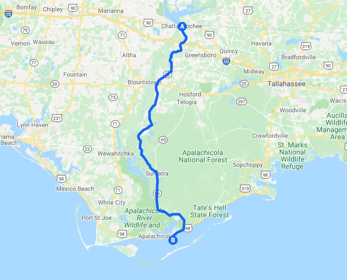
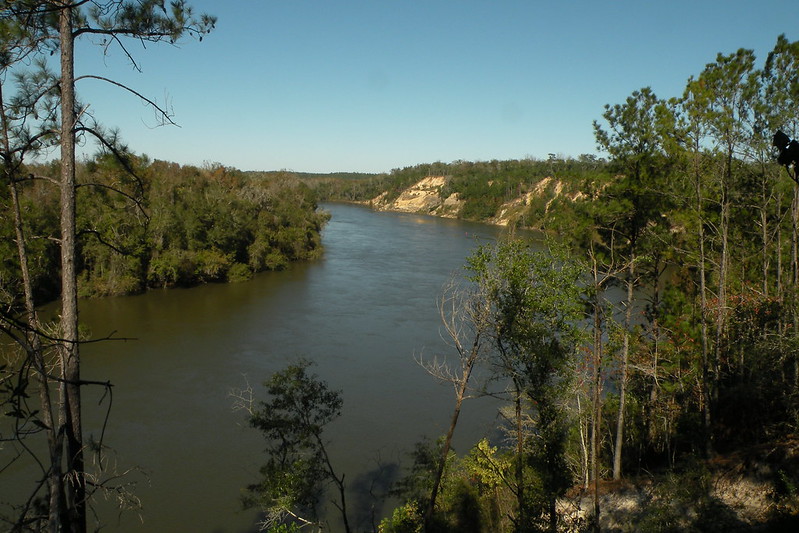
The Apalachicola River was a major transportation route in the early history of Florida.
It connected Alabama,Georgia and Florida agricultural and industrial enterprises to the Gulf of Mexico at Apalachicola.
Some towns along the river are Chattahoochee, Blountstown, Wewahitchka, and Apalachicola.
BLACKWATER RIVER
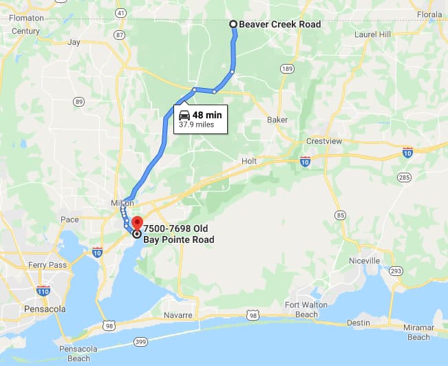
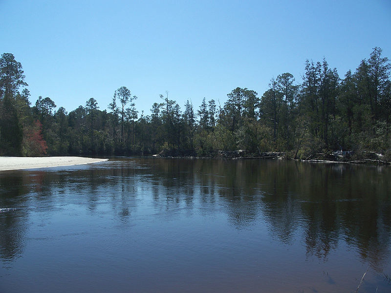
The Blackwater River rises in south Alabama and flows south through the Florida Panhandle to the Gulf of Mexico.
The river is navigable by small boats along a 31 mile stretch in Florida and is a popular kayak and canoe destination.
Milton is the principal town on this short but historic river.
CALOOSAHATCHEE RIVER
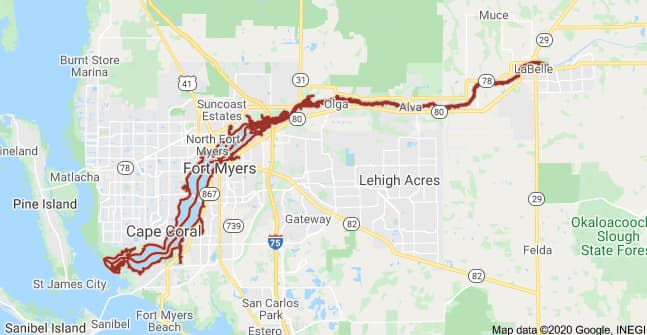
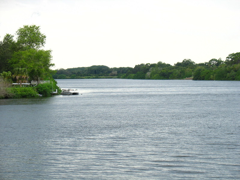
The Caloosahatchee River is 67 miles long. It begins in Lake Hicpochee and flows in a westerly direction to Fort Myers and Cape Coral where it discharges into the Gulf of Mexico.
Lake Hicpochee is connected to Lake Okeechobee by the five mile long Caloosahatchee Canal.
The river is part of the Okeechobee Waterway that connects the east coast of Florida to the west.
Some of the towns along the river are LaBelle, Alva, Fort Myers, and Cape Coral.
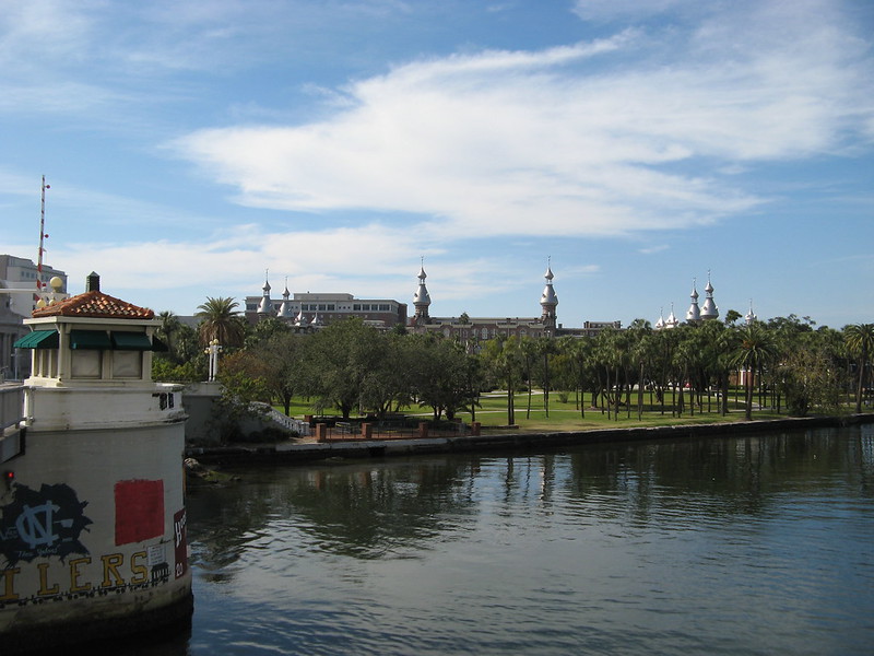
HILLSBOROUGH RIVER
The Hillsborough River begins near the southern end of the Withlacoochee River and flows 54 miles southwesterly to Tampa.
It serves as an overflow for the Withlacoochee River and its waters are replenished by Crystal Springs about nine miles south of the headwaters.
The main towns on this river are Tampa and Temple Terrace. It is also the location of Hillsborough River State Park.
KISSIMMEE RIVER
The Kissimmee River begins near St. Cloud as an outfall from East Lake Tohopekaliga.
It flows through Lake Tohopeklaiga at Kissimmee, Lake Cypress, Lake Hatchineha, and Lake Kissimmee before reaching Lake Okeechobee 103 miles south.
Kissimmee is the main town on the river. The river was channelized and straightened by the U.S. Army Corps of Engineers.
This caused much environmental damage, and now the river has been restored to its original path after many years and more than one billion dollars.
OCKLAWAHA RIVER
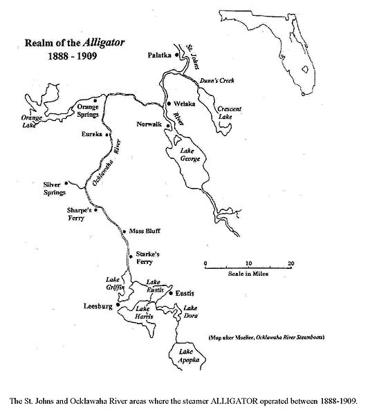
The Ocklawaha River is 74 miles long and flows north from Lake Griffin near Leesburg to the St. Johns River near Palatka.
Lake Griffin was connected to Lakes Harris, Eustis, Dora, Beauclair, and Lake Apopka with a series of canals including Haynes Creek, Dead River, Dora Canal, and Apopka-Beauclair Canal.
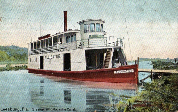
Towns on the river and Harris Chain of Lakes include Eustis, Leesburg, Fruitland Park, Tavares, Mount Dora, and Howey-In-The-Hills. The steamboat Alligator carried people and freight to these towns.
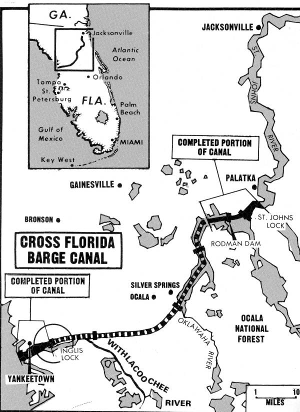
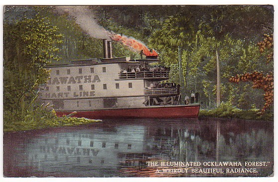
The Ocklawaha River was an important and historic water route that transferred freight and passengers from the deep water port of Palatka on the St. Johns River onto smaller paddle wheel steamers that went to Silver Springs and all the way south to Mount Dora.
A cross-state barge canal was started during the Great Depression, was stalled for years, then resurrected in the 1960s, and finally killed for good although some environmental damage was done.
The Rodman Reservoir was completed and changed the ecology of the area as well as the flow characteristics of the river.
There is an ongoing movement among environmental groups to remove the Rodman dam and let the river come back to its original condition.
PEACE RIVER
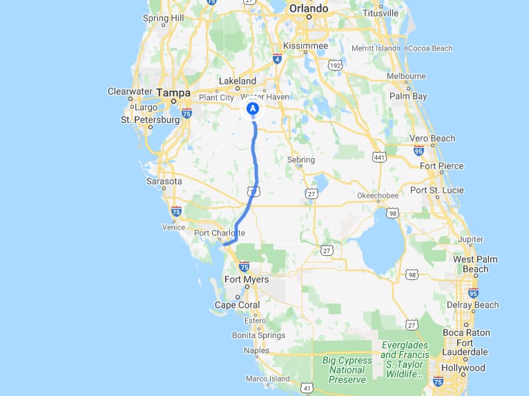
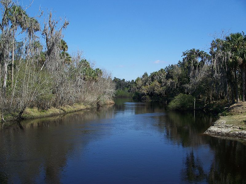
The Peace River begins northeast of Bartow, Florida and extends 106 miles south to Punta Gorda at Charlotte Harbor on the Gulf of Mexico.
US-17 parallels the river most of the way. The river was named Rio de la Paz by the Spanish in the 1500s.
Some towns along the way are Fort Meade, Bowling Green, Wauchula, Zolfo Springs, Arcadia, and Fort Ogden.
Many of these towns are described in Old Florida Towns on US-17 south of I-4.
ST JOHNS RIVER
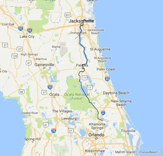
The St. Johns is a north flowing river on Florida's east coast that begins in Blue Cypress Lake near Yeehaw Junction.
It flows north for 310 miles to the Atlantic Ocean near Mayport. It was Florida's major transportation route in the era before railroads.
"River of Lakes" is an excellent natural history of the St. Johns River written by the late Bill Belleville. It is a book that you will want to read more than once.
Important towns along the river are Mayport, Jacksonville, Mandarin, Green Cove Springs, Palatka, Enterprise, and Sanford. These towns and others are profiled in
OLD TOWNS ON THE ST. JOHNS RIVER
ST. MARKS RIVER
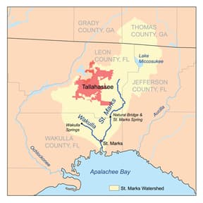
The St. Marks River begins in Leon County not far from Tallahassee and flows 36 miles south into Apalachee Bay at the Gulf of Mexico.
Along the way it joins the Wakulla River near the town of St. Marks. The river was one of the earliest important transportation systems in this part of Florida.
St. Marks is the main town on the river.
SUWANNEE RIVER
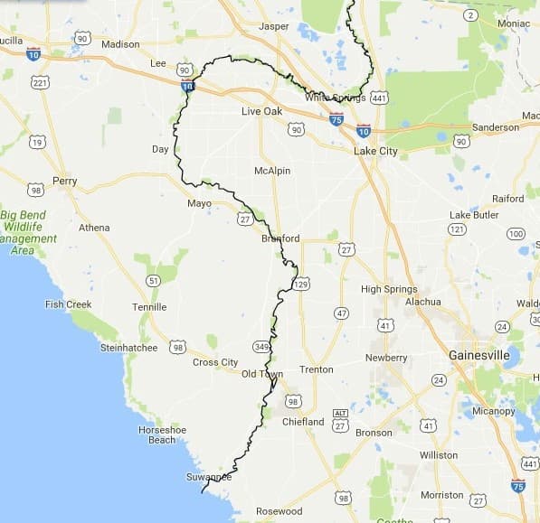
The Suwannee River rises in the Okeefenokee Swamp of south Georgia and meanders more than 238 miles southward through mostly rural Florida farmlands and conservation areas. 206 of those miles are in Florida.
It is famous as the setting for Florida's state song, "Old Folks at Home." Some towns along the river are White Springs, Branford, Old Town, and Suwannee. The places and others are profiled in
OLD TOWNS AND PLACES ON THE SUWANNEE RIVER
INDIAN RIVER LAGOON SYSTEM
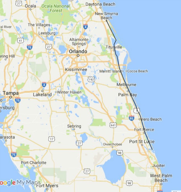
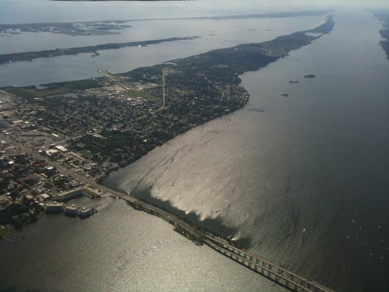
The Indian River and its lagoon system were important to the development of Florida's east coast. It is not really a river, it is a saltwater lagoon.
It's too important not to mention, however, and we love it so have included it. You can learn more about Indian River history and places at
MORE INFORMATION ON FLORIDA RIVERS
"Florida's Rivers," an excellent book by Charles R. Boning, lists 60 Florida rivers and describes them in detail.
I recommend this book to any person who wants an in depth understanding of Florida rivers including their history, flora, fauna, and hydrology characteristics.

Florida is the fastest-growing state in the United States and also the fastest-changing. If you see anything in this article that has changed or is in error, please let me know.
Thousands of Florida fans subscribe to our free daily Ezine, Florida Heritage Travel and we have 130,000 followers on Facebook.
By Mike Miller, Copyright 2009-2025
Florida-Back-Roads-Travel.com
Florida Back Roads Travel is not affiliated with or endorsed by Backroads, a California-based tour operator which arranges and conducts travel programs throughout the world.
