- Home
- Florida Road Trips
- Central East Florida Road Trips
CENTRAL EAST FLORIDA
ROAD TRIPS AND SCENIC DRIVES
By Mike Miller Updated September 2, 2023
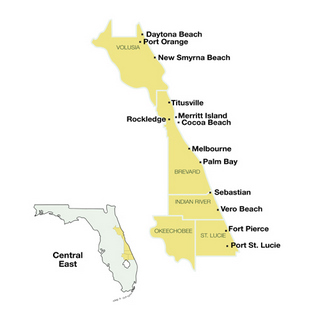
Central East Florida road trips and scenic drives are designed to show you some of the most interesting spots off the beaten path in this narrow region along the east coast of Florida.
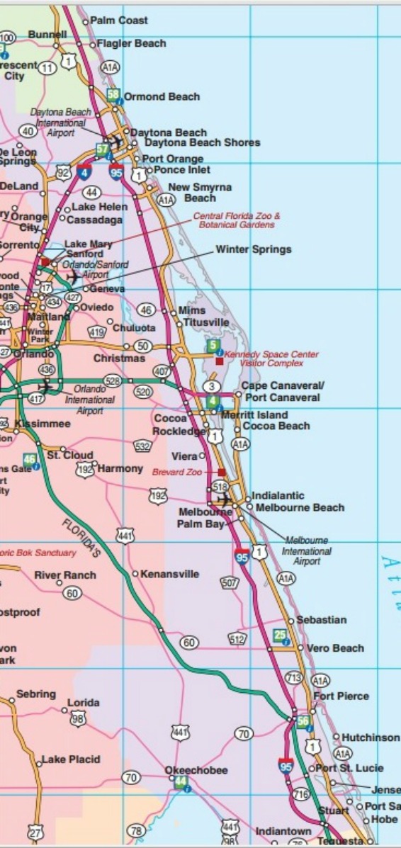
I-4 is the east-west interstate in this region. It crosses the state of Florida from Daytona Beach through Orlando to Tampa. I-95 is the north-south interstate in this region. It comes in from Georgia and goes all the way down to Miami.
The Florida Turnpike is a major toll road on the west side of Indian River and St. Lucie Counties. The Turnpike starts in Wildwood south of Ocala and terminates in Miami. A branch of the Turnpike splits off north of Miami and heads south and east to Homestead on the way to the Florida Keys.
The interstate exits are crowded with gas stations, fast food restaurants and motels. The Turnpike also has oases with gas and food.
You can travel the state quickly and easily on these highways (except during rush hours), but not see as much scenery or real towns as you will on our recommended Central East Florida day trips.
The town signs you do see are usually several miles from the downtown section. The fun begins when you get off the turnpike and interstate and hookup with the less traveled roads.
There are many state and county highways off the interstate that offer better scenery and a look at real towns. In Florida, some backroads are even four-lane.
Here are a few Central East Florida day trips and one tank trips that I recommend:
Central East Florida Road Trips & Scenic Drives with Highway Maps
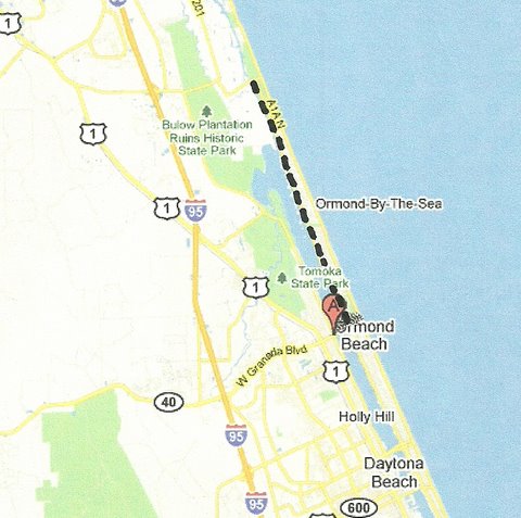
Road Trip 1: Anderson Drive from Highbridge to Ormond Beach
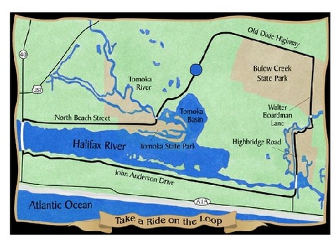
Anderson Drive from Highbridge Road south along the east side of the Halifax River to Ormond Beach. Beautiful river views and tree canopies; fine houses and tranquil neighborhoods. About 9 miles.
 Garden Across from the Casements
This trip could be incorporated into a larger trip known as The Loop. It is one of the most scenic loops in Florida and is very popular with cyclists as well as bikers during Daytona Beach Bike Week.
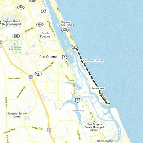
Road Trip 2: South Daytona Beach to Ponce Inlet on South Atlantic Ave
SR-A1A south of Daytona Beach from the Port Orange bridge south to Ponce Inlet. End of the road community, great inlet, historic Ponce Inlet Lighthouse, good restaurant. One of the nicest Central East Florida day trips. About 6 miles.
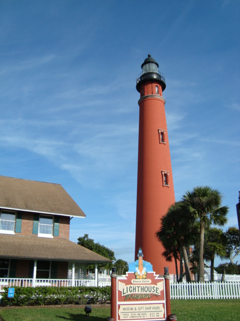 Ponce Inlet Lighthouse
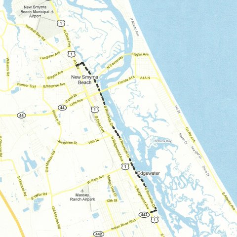
Road Trip 3: New Smyrna to Edgewater along the Indian River
The river road from north New Smyrna Beach to Edgewater . Close to the river, old houses, beautiful trees. This beautiful scenic route parallels and is on the east side of US-1. You will pass by the city marina downtown and the nice little New Smyrna Yacht Club just north of Edgewater. About 4 miles.
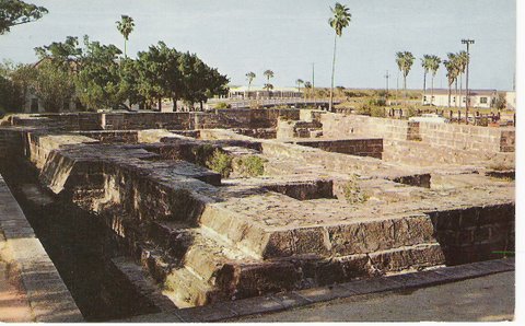 Old Ruins in Downtown New Smyrna Beach
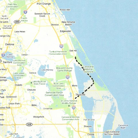
Road Trip 4: Oak Hill, Kennedy Space Center, & Titusville on Florida State Road 3
Leave US-1 south of Oak Hill and take SR-3 into the top of Kennedy Space Center, then west on SR-406 to Titusville. You will pass a couple of real old pioneer houses in Shiloh, Baker's Haulover Canal south of Shiloh and lots of wilderness and wildlife all enhanced by the mystique of the missile center and the giant looming presence of the Vehicle Assembly Building. About 25 miles.
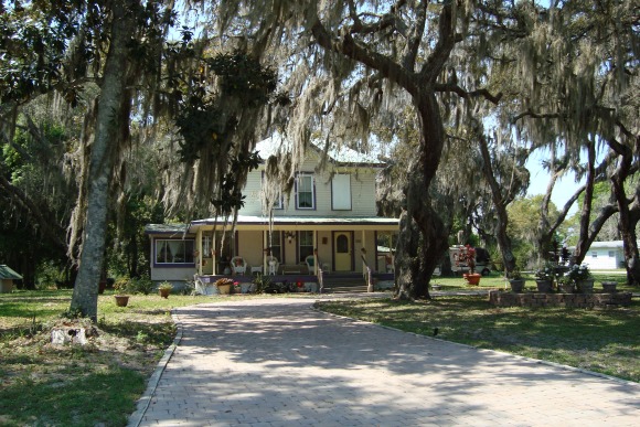 House in Oak Hill
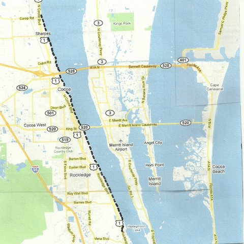
Road Trip 5: Williams Point through Cocoa along the Indian River
The river road from Williams Point on US-1 north of
Cocoa,
south through Cocoa Village, Rockledge, and Bonaventure. This road
parallels US-1, and ties back into it at the south end. One of the most
beautiful roads in Florida. Close to the river, some pretty high rocky
bluffs in Cocoa, quaint Cocoa Village, fine old houses and big oak and
palm trees and lots of Spanish Moss. About 20 miles.
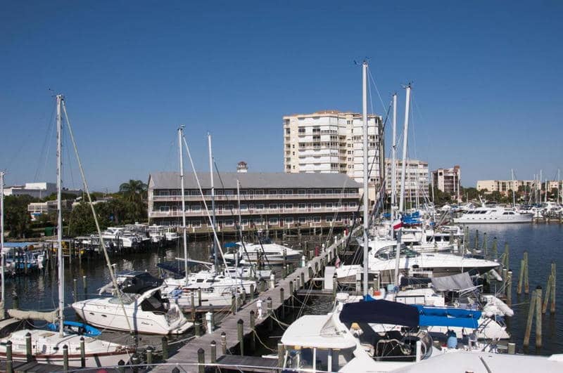 Mariner Square Downtown Cocoa
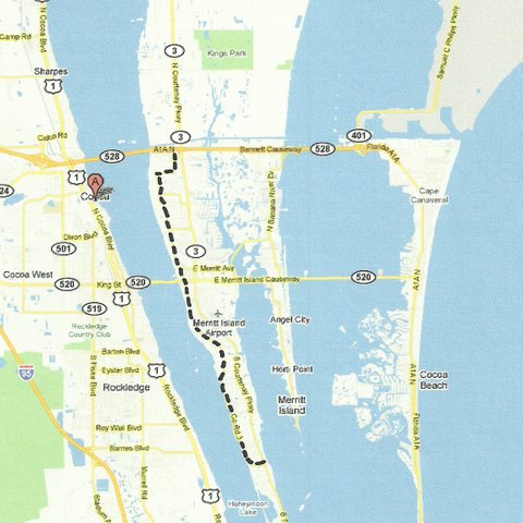
Road Trip 6: Merritt Island to Georgianna on Tropical Trail
Tropical Trail on Merritt Island from just south of the barge canal to SR-3 at Georgiana. Old Florida that has been bypassed by the newer SR-3. Great old houses and trees. Stop and visit the old Georgiana Methodist church and the nearby cemetery to see the graves of Merritt Island pioneers. About 10 miles.
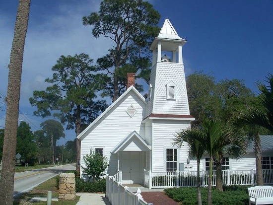 Georgiana United Methodist Church
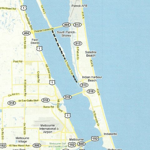
Road Trip 7: Pineda Causeway to Mathers Bridge on South Tropical Trail
SR-3 from the Pineda Causeway(SR-404) south to the Mathers Bridge at the south end of Merritt Island. This is known as South Tropical Trail. You will enjoy a constant and beautiful Indian River view on your right as you drive along, and stately homes on your left that front on the Banana River. About 4 miles.
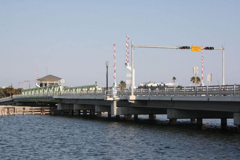
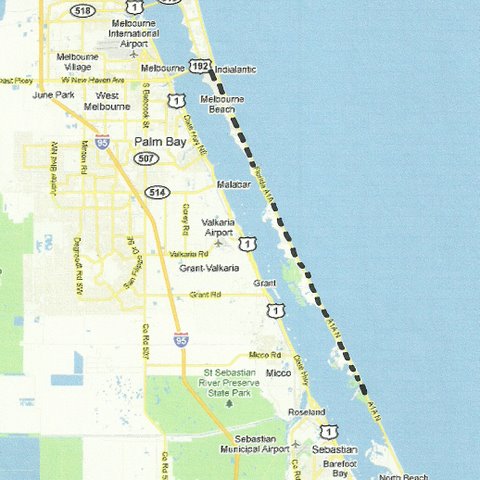
Road Trip 8: Indialantic to Sebastian Inlet on Florida State Road-A1A
SR-A1A from US-192 at Indialantic south to Sebastian Inlet. Low density development, fine beaches with lots of public access, great fishing and a nice jetty jutting into the ocean at the inlet. About 22 miles.
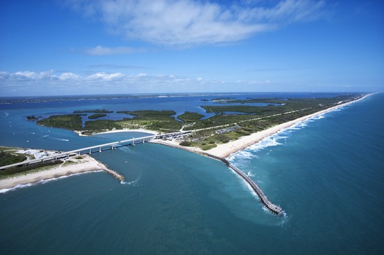 Sebastian Inlet
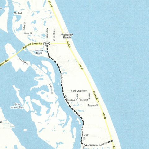
Road Trip 9: Wabasso Beach to Vero Beach on Jungle Trail
Jungle Trail from SR-510 at Wabasso Beach south along the east side of the Indian River to Johns Island, and back to SR-A1A north of Indian River Shores and Vero Beach. Real old Florida. Was not paved last time I drove it, but easily passable in a normal passenger car. About 4 miles.
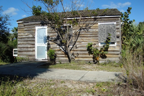 Pioneer Cabin on Jungle Trail
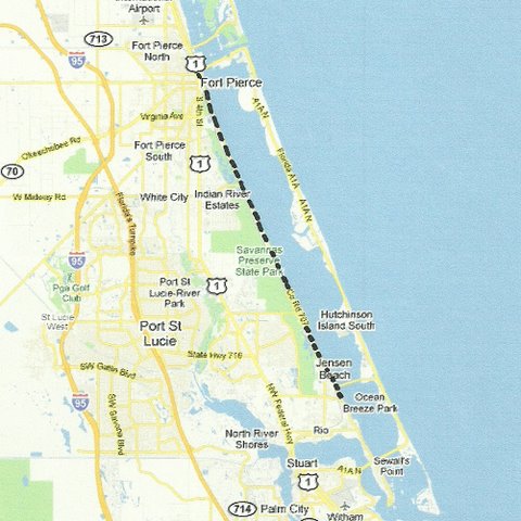
Road Trip 10: Fort Pierce to Jensen Beach along the Indian River
Indian River Drive from Fort Pierce along the west side of the Indian River to Jensen Beach. Wonderful road hugs the river, beautiful old houses, historic places and magnificent trees. About halfway down you will see the giant St. Lucie nuclear power plant looming up over the barrier island. About 18 miles.
Another excellent day trip for Central East Florida is to drive to Cape Canaveral and enjoy a day at the beach at Cherie Down Park. The park page has a map that shows you exactly where it is located and how to get there.
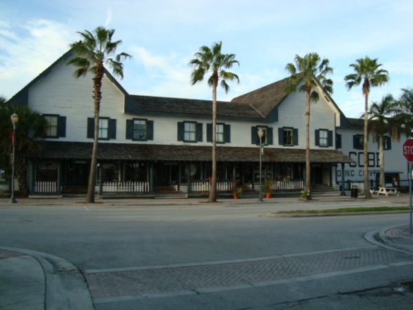 Cobbs General Store, Fort Pierce
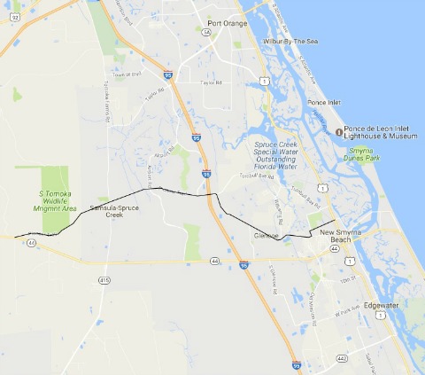
Road Trip 11: New Smyrna Beach Pioneer Trail Shortcut
From US-1 in New Smyrna Beach take Wayne Avenue past the country club to Halleck Street. Go south on Halleck to Enterprise Ave which becomes Pioneer Trail. Follow Pioneer Trail west to its intersection with SR-44. Pioneer Trail is also known as Volusia County Rd 4118. About halfway along this route you will come to Cabbage Patch Bar and Cacklebery Campground, favorite hangouts for bikers, at Tomoka Farms Road. About 14 miles.
Our Facebook page has more than 130,800 followers who love off the beaten path Florida: towns, tourist attractions, maps, lodging, food, festivals, scenic road trips, day trips, history, culture, nostalgia, and more.
- Home
- Florida Road Trips
- Central East Florida Road Trips
By Mike Miller, Copyright 2009-2025
Florida-Back-Roads-Travel.com
Florida Back Roads Travel is not affiliated with or endorsed by Backroads, a California-based tour operator which arranges and conducts travel programs throughout the world.
