- Home
- City Street Maps
FLORIDA CITY AND TOWN MAPS
We use Google and Florida Department of Transportation (FDOT) maps as our source of local information for all of the towns and cities on our website.
The maps below are arranged in alphabetical order from top to bottom.
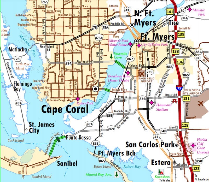
CAPE CORAL FORT MYERS
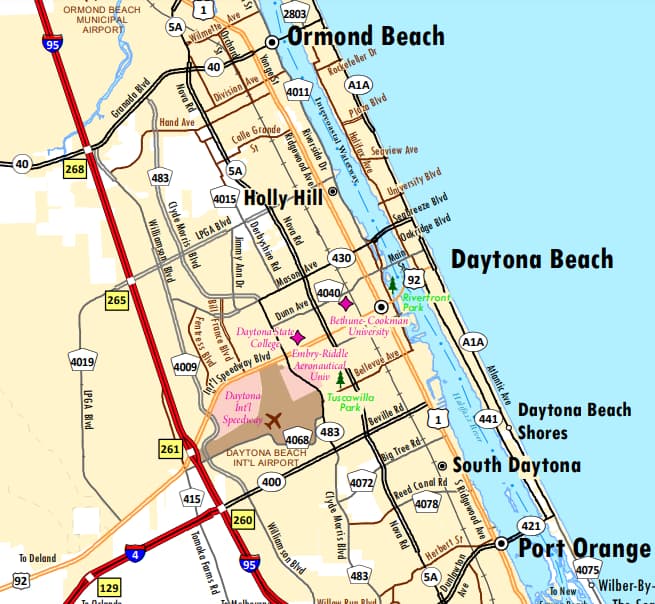
DAYTONA BEACH ORMOND BEACH
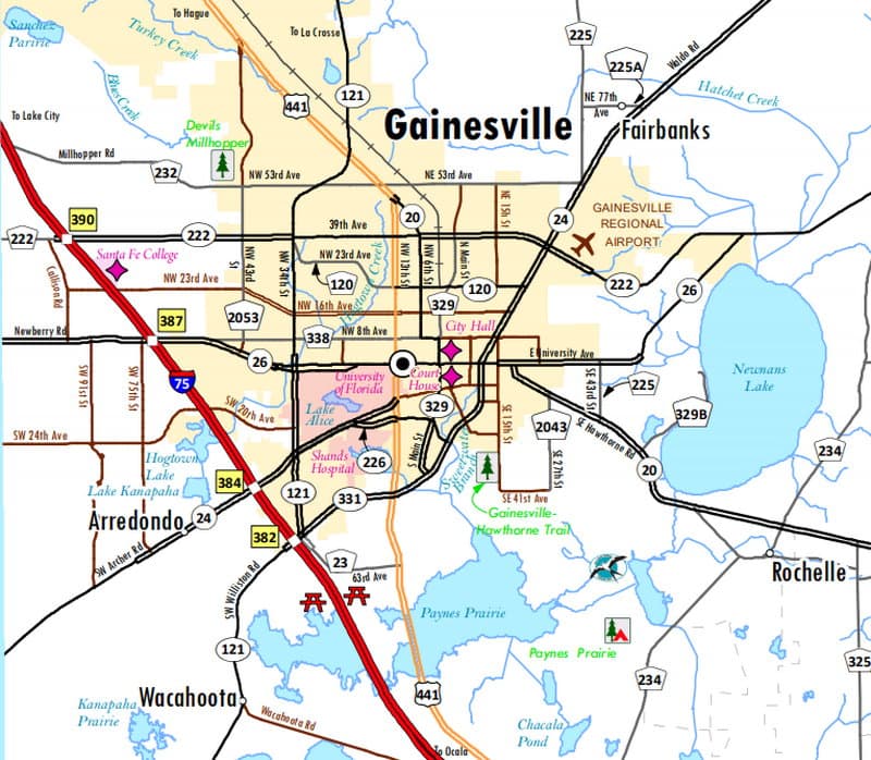
GAINESVILLE
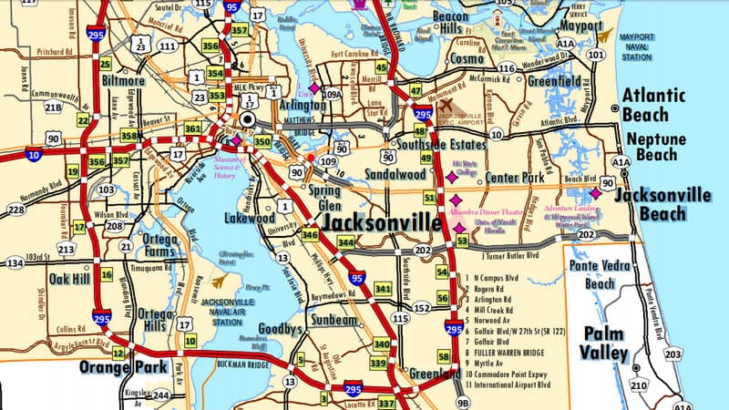
JACKSONVILLE
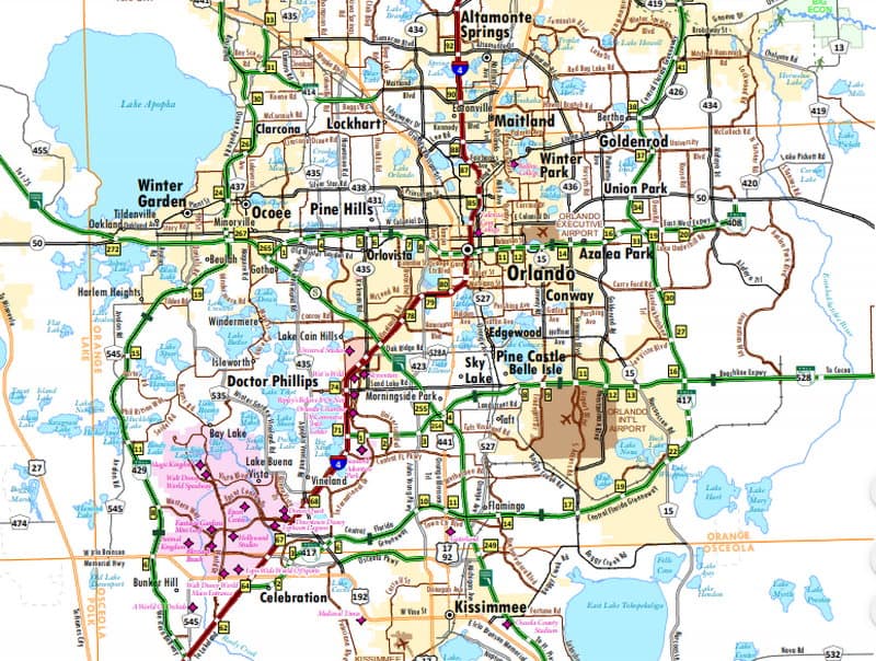
ORLANDO
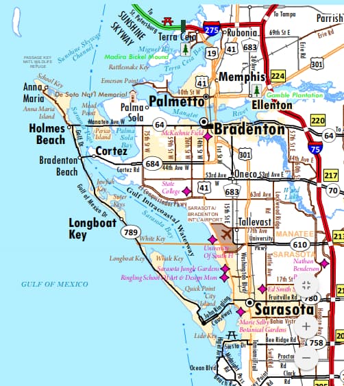
SARASOTA BRADENTON
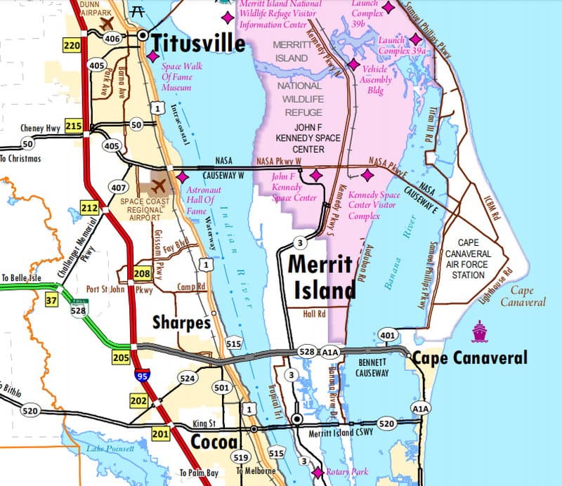
SPACE COAST TITUSVILLE COCOA MERRITT ISLAND
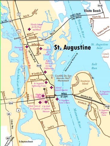
ST. AUGUSTINE
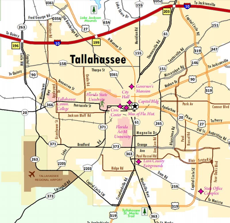
TALLAHASSEE
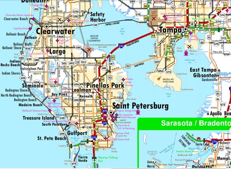
TAMPA CLEARWATER ST PETERSBURG
MIAMI AND SOUTHEAST FLORIDA

THE VILLAGES FLORIDA

Click the image of the FDOT map below and you will see a PDF map of the state which you can zoom in on and see details for your area of interest.

Click on any of the towns below and you will be taken to an interactive Google map of the city and a ton of information about the place.
Alva
Anna Maria
Apalachicola
Arcadia
Aripeka
Astor
Auburndale
Ave Maria
Avon Park
Babson Park
Bartow
Boca Grande
Boca Raton
Bokeelia
Bowling Green
Boynton Beach
Bradenton
Branford
Briny Breezes
Bristol
Bronson
Brooksville
Cabbage Key
Cape Coral
Captiva
Carrabelle
Cassadaga
Cedar Key
Celebration
Chipley
Chokoloskee
Clearwater
Clermont
Cocoa
Cocoa Beach
Coconut Grove
Coral Gables
Cortez
Crescent City
Crestview
Cross-Creek
Crystal River
Dade City
Daytona Beach
Deer Island
DeLand
Defuniak Springs
Delray Beach
Doctor Phillips
Dowling Park
Dunedin
Dunnellon
Edgewater
Englewood
Enterprise
Espanola
Eustis
Everglades City
Fanning Springs
Fernandina Beach
Flagler Beach
Floral City
Fort Lauderdale
Fort Meade
Fort Myers
Fort Ogden
Fort Pierce
Frostproof
Fruitland Park
Gainesville
Glen St. Mary
Graceville
Grayton Beach
Green Cove Sprs
Gulfport
Haines City
Havana
Highland Park
High Springs
Hillsboro Inlet
Hollywood
Homestead
Homosassa
Howey In The Hills
Indialantic
Indiantown
Interlachen
Inverness
Jacksonville
John's Pass
Juno Beach
Jupiter
Kenansville
Key Biscayne
Key Largo
Keystone Heights
Key West
Kingsley Lake
Kissimmee
Labelle
LaGrange
Lake City
Lakeland
Lake Placid
Lake Wales
Lauderdale-By-The-Sea
Leesburg
Lighthouse Point
Live Oak
Long Key
Macclenny
Madeira Beach
Madison
Mandarin
Marco Island
Marianna
Matlacha
Mayo
Mayport
Maytown
McIntosh
Melbourne
Melbourne Beach
Melrose
Miami
Micanopy
Milton
Mims
Monticello
Montverde
Moore Haven
Mount Dora
Mount Plymouth
Nalcrest
Naples
Newberry
New Smyrna Beach
Oakland
Oak Hill
Ocala
Ocklawaha
Ocoee
Okeechobee
Old Naples
On Top of the World
Orlando
Ormond Beach
Ozello
Paisley
Palatka
Palm Beach
Palmdale
Panama City
Pass A Grille
Penney Farms
Pensacola
Pine Island
Pineland
Plant City
Pompano Beach
Ponce Inlet
Port Orange
Port Salerno
Port St Joe
Port St Lucie
Punta Gorda
Quincy
Rockledge
Safety Harbor
Sanford
Sanibel
Sarasota
Satellite Beach
Seaside
Sebastian
Sebring
Siesta Key
Silver Springs
Sopchoppy
St Augustine
St Cloud
St James City
St Leo
St Marks
St Petersburg
Steinhatchee
Stuart
Surfside
Suwannee
Tallahassee
Tampa
Tarpon Springs
Tavares
Temple Terrace
The Villages
Titusville
Trenton
Two Egg
Umatilla
Useppa Island
Venice
Vernon
Vero Beach
Wauchula
Welaka
West Palm Beach
White Springs
Williston
Windermere
Winter Beach
Winter Garden
Winter Haven
Winter Park
Yeehaw Junction
Our Facebook page has more than 130,000 followers who love off the beaten path Florida: towns, tourist attractions, maps, lodging, food, festivals, scenic road trips, day trips, history, culture, nostalgia, and more. We post articles every day. Please check it out and if you like it, we would appreciate a "like" from you.
By Mike Miller, Copyright 2009-2024
Florida-Back-Roads-Travel.com
Florida Back Roads Travel is not affiliated with or endorsed by Backroads, a California-based tour operator which arranges and conducts travel programs throughout the world.
Recent Articles
-
Surfside, Florida. Home of the Famous Surf Club
Apr 24, 24 06:16 PM
 Surfside, Florida is a small town of 6,000 located between Miami Beach and Bal Harbour.